We arrived at Sutton Hoo (the site of two early medieval cemeteries from the 6th -> 7th century) in the county of Suffolk at 11.55am on 24th April – (after some confusion navigating), while there were smells of something wafting around the car park, which was where a visitor welcome tent was reached.
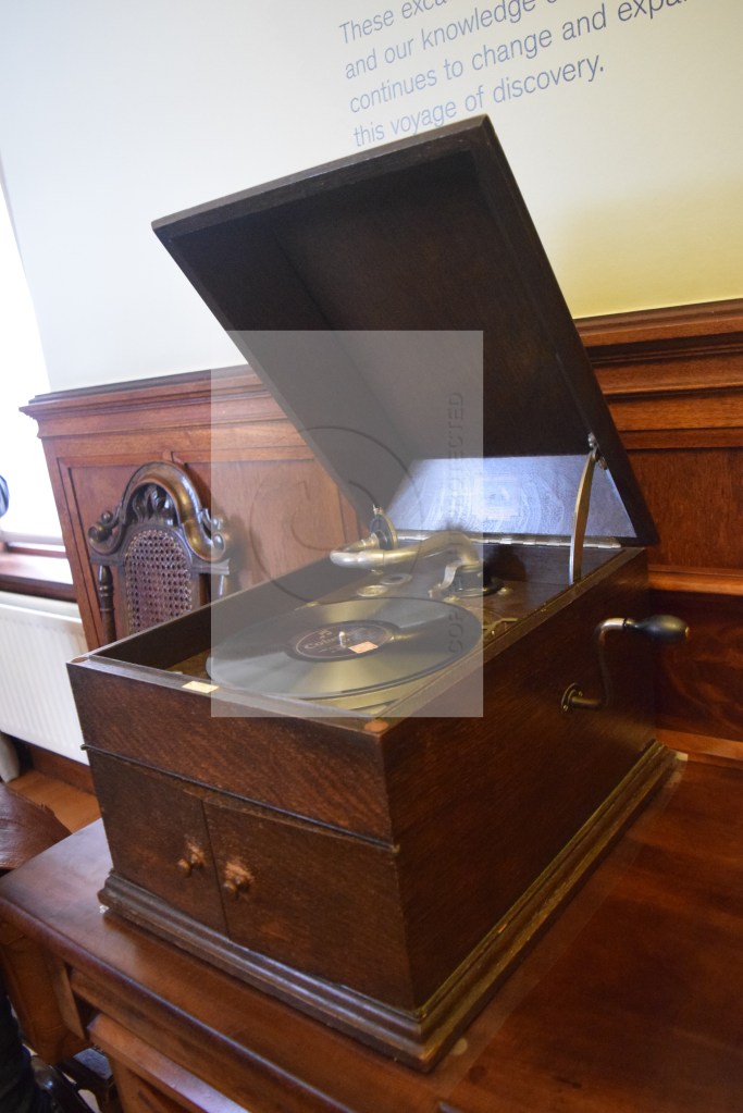
7 minutes later we’d passed a very fluffy Retriever being walked, a Jack Russell in a dog pram, and a very enthusiastic looking Pug walking; and Mum wanted coffee, the cafe was looking very busy, but thankfully a table freed itself before we sat down outside, as temperatures were chilly out there. An enthusiastic Labrador pulled his or her owner through the door while I consumed a cookie – and it was 12.28pm when we moved again – into the nearby Tranmer house (owned by Edith Pretty from 1926 – until her death in 1942), a wind up record player was in the entrance hall, and a volunteer wound it up; and in the next room was – among other things – Basil Brown’s tape measure (he was an amateur archaeologist invited by Edith to explore the land around her property as the mounds found on the land looked like burial mounds). Photographs from the boat’s unearthing in 1939 were being projected on to a screen in the room after that; and the next one had a few little costumes for kids to put on (and then attempts could be made by them to try and draw a small archaeological plan, and piece together a pot).
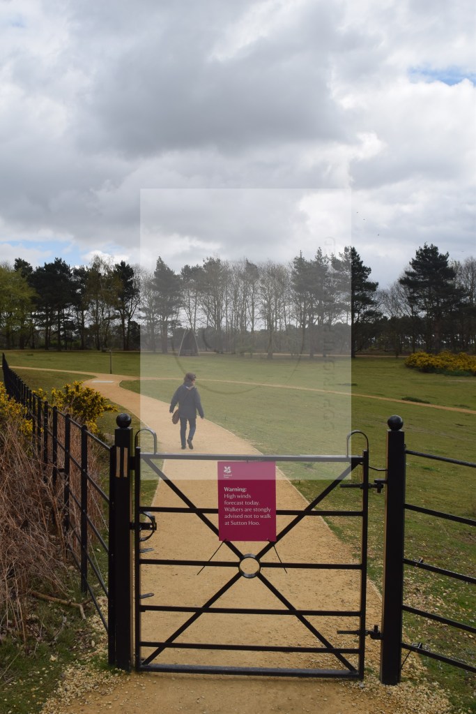
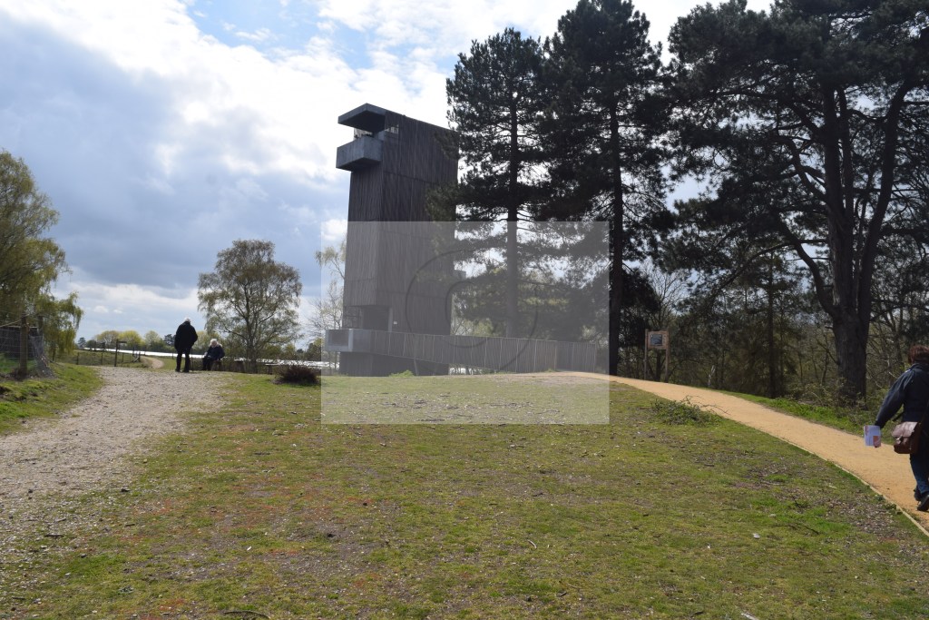
Outside again in the freezing winds, a notice about walkers being strongly advised not to take this path due to the strong winds forecast today was on a small gate, so we ignored it, and at 1.12pm reached a big slab in the ground telling us we were stood between 2 of the Hoos of Sutton Hoo (a hoo means a raised area of land in old English). We went up the one on the left, and rabbit holes were all over the place, signs to the royal burial ground and the viewing tower were followed, I almost fell over a half buried rock in the path – meaning my right foot was hurting a lot when the viewing tower was reached at 1.25pm: a sign said there were 81 steps to the top, it took us 4 minutes to get up there, and the pig farm I’d spotted earlier was more visible.
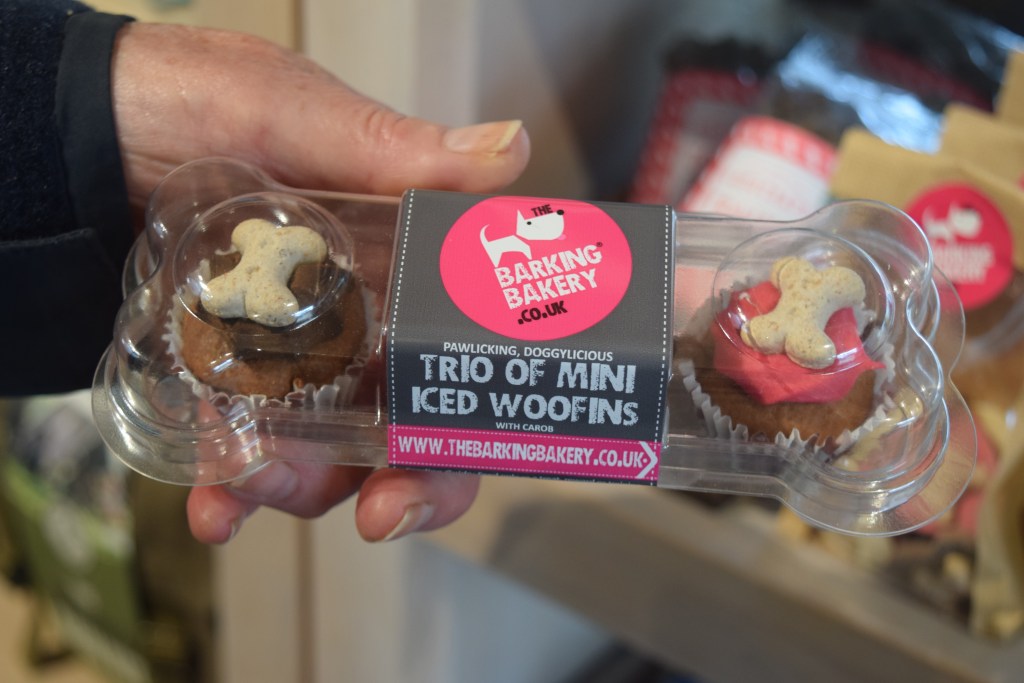
When we were back on ground at 1.36pm, the Valley Walk signs continued to be followed, so we re -approached the restaurant sat in earlier. Inside was a massive Retriever (seated with a husband and wife at 1 table), a couple of little dogs with 4 people at another table (we weren’t sure of the breed – I subtly took a couple of pictures with my phone, but Google wasn’t sure about either dog when I attempted to find out later), a sausage roll and ‘ziggys famous rarebit’ were shared (as I wasn’t sure what rarebit was and it sounded interesting), my foot was feeling like it was going to drop off when we moved just before 1.30pm – and I noticed iced woofins for dogs, soft toy acorns, wooden swords, and lots of other edible things for dogs from The Barking Bakery in the shop before we entered ‘The Heart Of A Kingdom’ exhibition just before 2.30pm (in a very dark room).
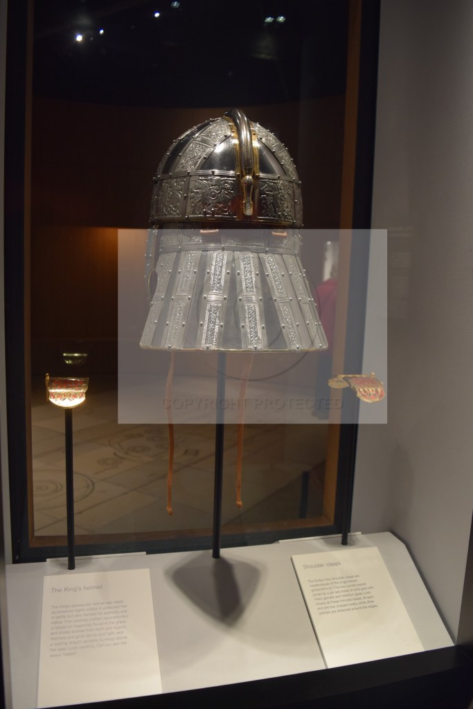
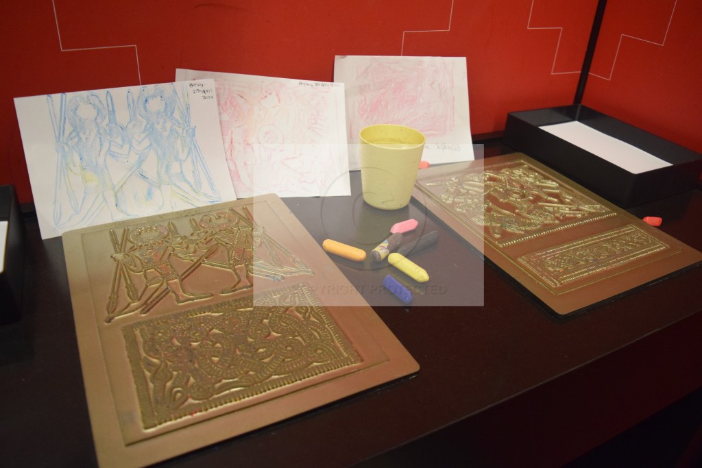
There was a big cauldron, a couple of wooden buckets (and apparently when the King of East Anglia – King Raedwald – died in 625AD he was buried with 4 wooden buckets), a drinking horn, and examples of a lyre and a lyre bag, of a Hnefatafl (pronounced neffa raffle) game, and of Anglo-Saxon textiles; some kids activities included brass rubbing (which I hadn’t done for about 20 years – so I did it), a metal helmet worn by the king was on another shelf, and in a rather dark room were fragments of excavated things, along with holograms of people (from all walks of life – talking about their role in the community during King Raedwald’s time) adorning the walls.
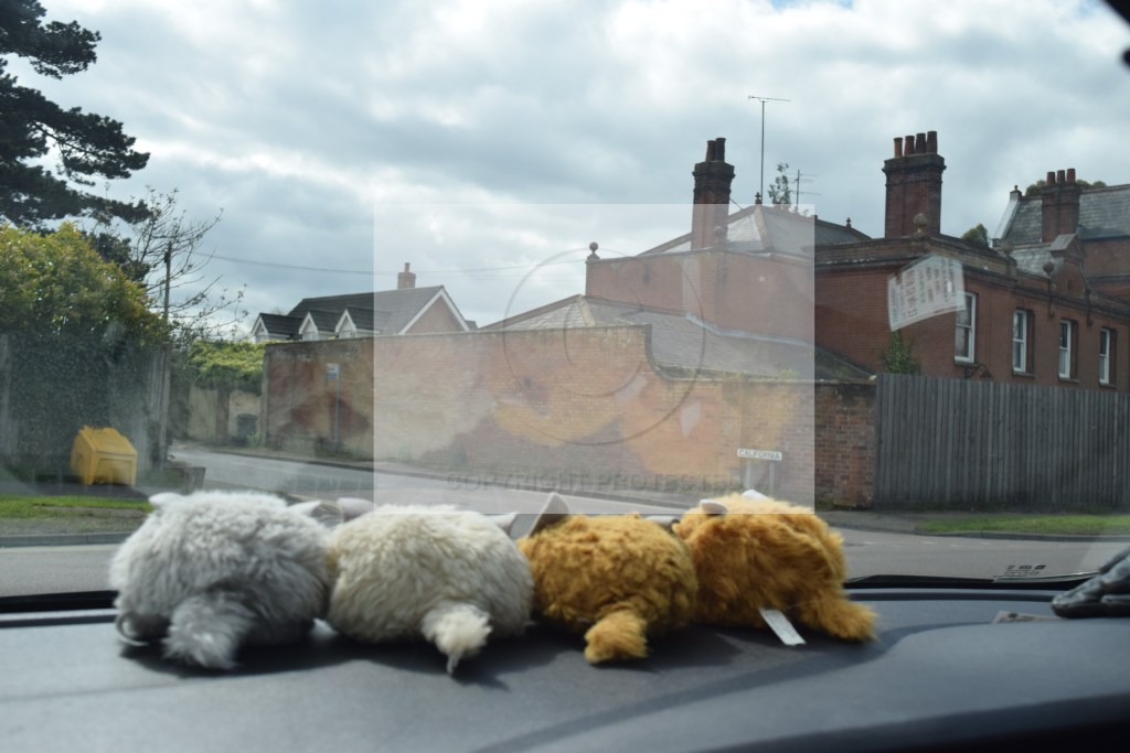
It was 3.19pm and just starting to rain when we got back to the car – and my foot still felt like it was about to drop off. A tiny village called Sutton, followed by Shottisham, and Alterton – led to Bawdsey and the North Sea coast at 3.42pm, which had seagulls making loud noises out on the sea, extremely cold winds, and an extremely pebbly beach that we had a quick look round (and I gathered a few shells off), and it was 4.04pm when the car moved again (9°C – and the rain hadn’t started). After going back the other way through the villages we’d gone through 30 minutes later, Woodhall Manor was passed, the village of Sutton, then Bromeswell, Melton (with a miniscule 1 track railway station – and signs about a ‘mind, body, and spirit festival’ – on 22nd and 23rd April), and Woodbridge was re-entered at 4.30pm (and I saw a street called California – opposite The Duke of York pub). 20 minutes later we were still wiggling, were on Lower Road, and the Wild Hairy Haggis soft toys that always accompany us on these trips were remaining stable on the dashboard despite all the bumps; Culpho was passed through, then Mum decided we’d aim for Ipswich – which we found, but signage remained nonexistent, Valley Road there had cherry trees with blossom on, but otherwise everything was exceptionally grey, with traffic building very fast on the streets.
We’d seen 2 ambulances by the time we came off the A14 at 5.43pm – and there seemed to be a lot of diggers doing work around there; then in Stowmarket 5 minutes later – rush hour was clearly at its worst, and a woman wearing an orange hat with a green bobble on it looked like she had a carrot on the top of her head. While stuck on another road I noticed a dentists (that I forgot the name of) advertising facial rejuvenation; while passing the end of the road with our flat on I got a brief burst of WiFi and a few alerts on my phone, and we were back in the car park we’d left at 10.23am this morning at 6.01pm.

Leave a comment